For my first post-Google Divorce blog entry (thanks, WordPress), I thought I would share a few pics from our place in the Hill Country. I’m mainly doing this for family members with at least a somewhat vested interest, but the rest of you are welcome to tag along as well.
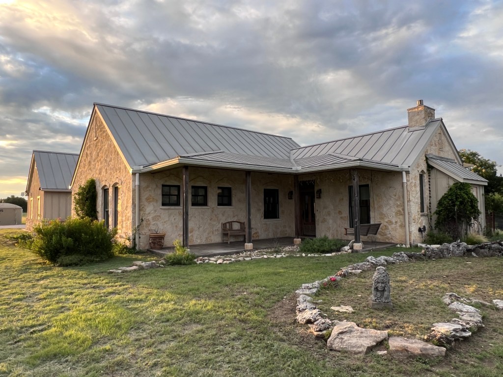
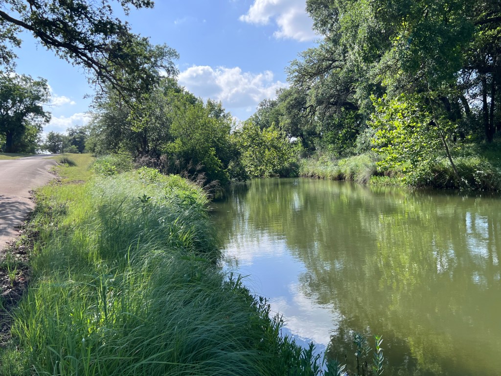
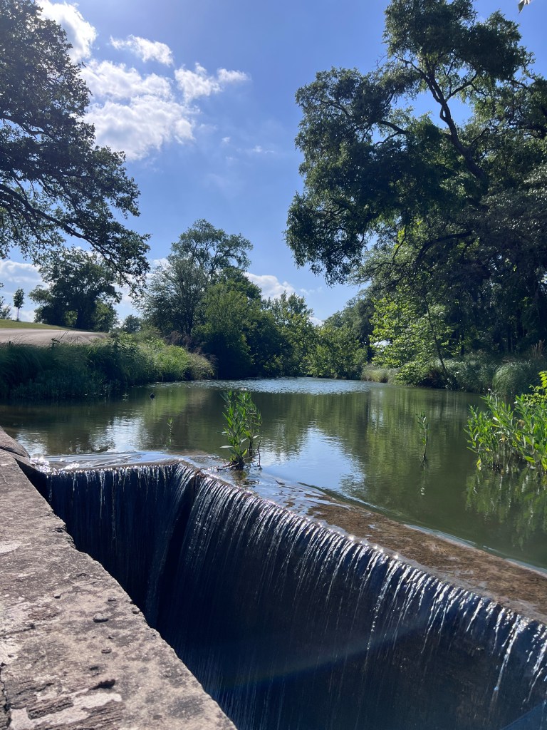
Although we’re between Fredericksburg and Harper, well north of the worst of the flooding in South Texas that you’ve all seen on the news, Spring Creek runs through our 45 acres. The main house and barn sit 40-50 feet directly above the creek, and the secondary house (formerly the wood shop) sits farther back on the other side of the driveway. It’s also about 75 yards closer to the creek where it crosses our concrete bridge that provides access to and from the road. The bridge has an open box that diverts the (typically minor) flow from upstream underneath the road and to the neighbor’s property on the other side.
Here are some captioned pics during peace-time that kind of set the stage:


On Thursday, we drove down from Kansas to take stock of things and stay for a bit. The best post-flood overview probably is from the video linked below. Please bear in mind that this was 36-48 hours AFTER the high water mark once the rain had stopped.
And for those of you familiar with the property, here’s the Schnerr Lane side. If you are not familiar with the property, from where I’m filming in this shot, the creek itself typically is almost invisible … and there is a 10-foot wide ford that you can drive across to access the property from the northwest side. Not so much anymore.
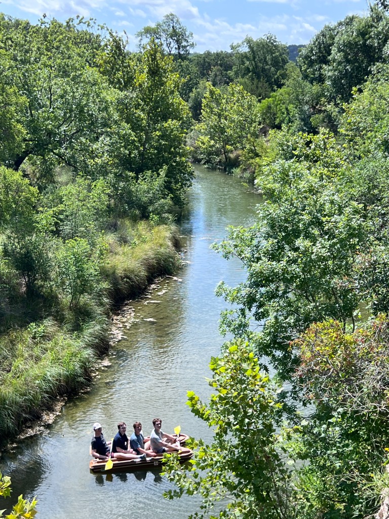
Here are a few more pics. To begin, there’s a before and after of the same area of the creek seen from the bluff where the house sits. In the first (pre-flood) picture, Hollis and his friends are on a boat. The following picture is one I took tonight from the same vantage point. The water level is 30-40 feet lower than it was 2-3 days ago, but you can see how much havoc was wreaked on vegetation / trees. A lot of that is just gone. You can also see debris in the little sycamore clinging to the canyon wall near the top on the right side.
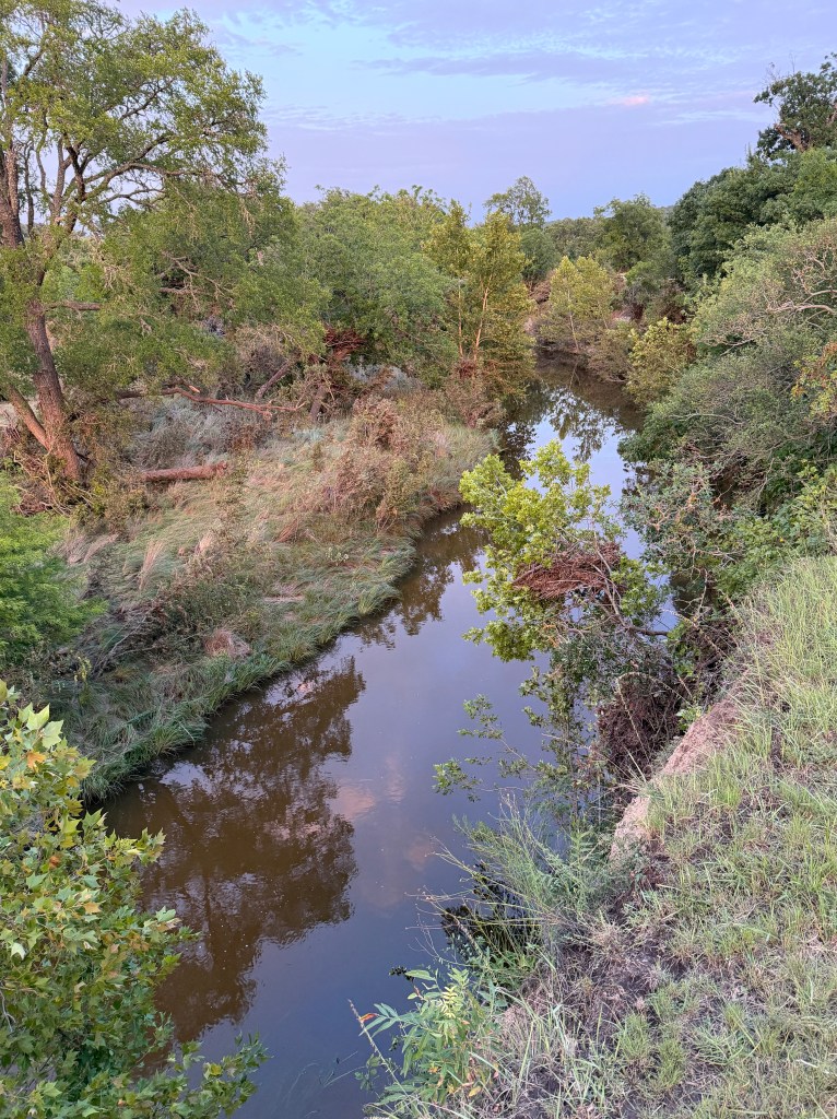
And here are a few from the other side of the creek looking back toward the house. Some of these pictures have circled areas showing areas of debris from the runoff. Again, this is primarily to provide some context for people who have been here before.

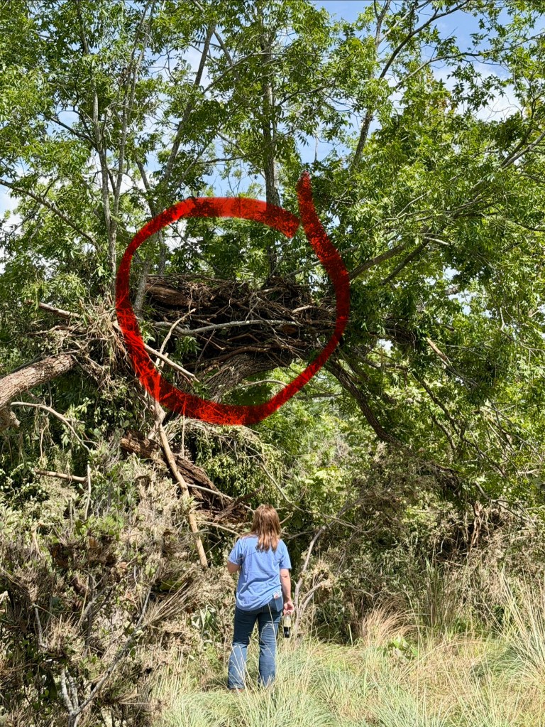
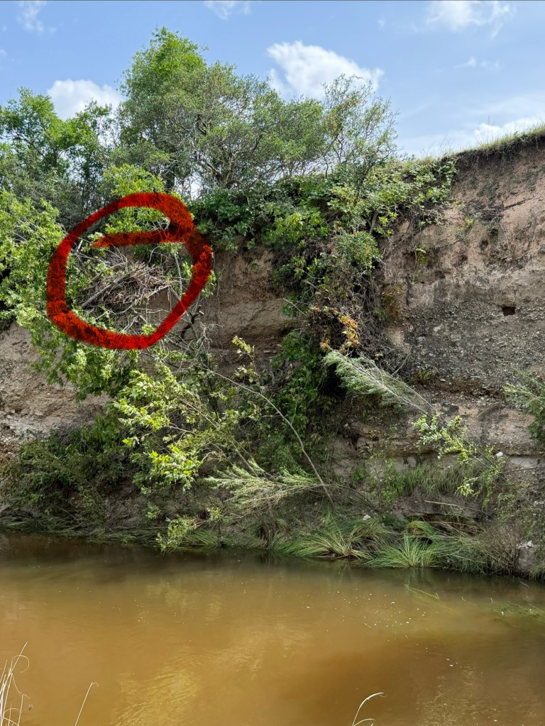
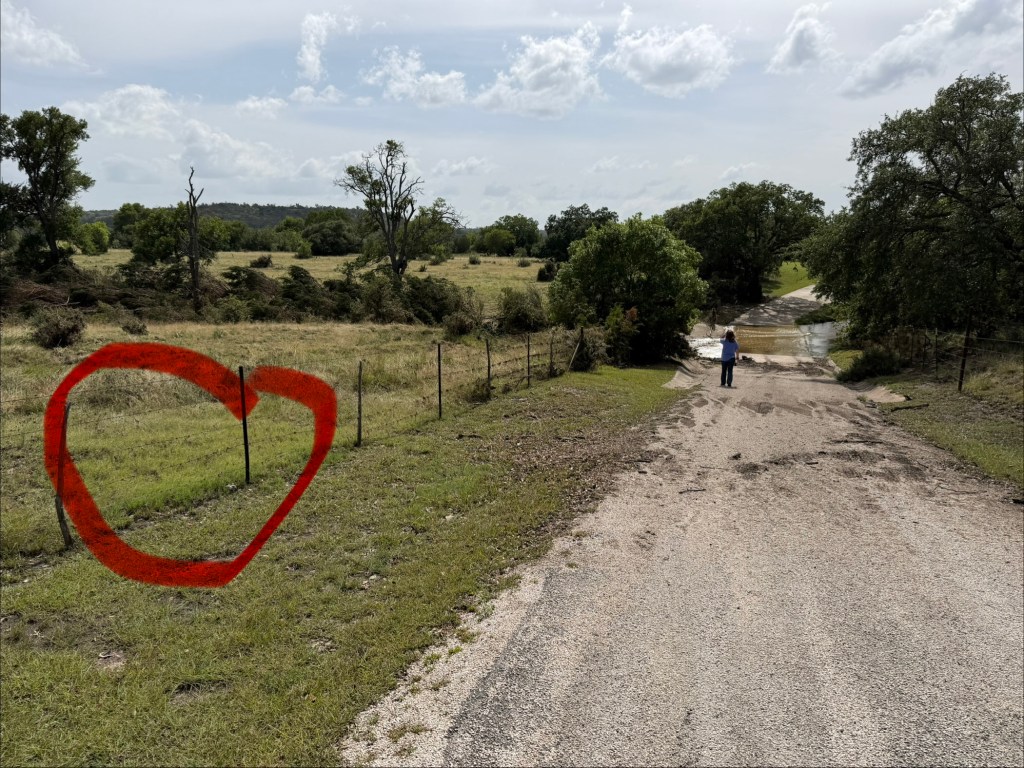
And finally, between the gate and the bridge, the circled area is the highest point at which there is debris in the fence.
Other points of note:
- The rancher who runs a few head of cattle on the property said that he measured 15+ inches over a 4-5 day period … far worse than during last year’s Guadalupe flood and the worst since the (presumably infamous) flood of 1978.
- Based on debris in trees, the water got to within 5-7 feet of the rim of the bluff where the house sits. If you’ve been here, you can appreciate how unimaginable that is.
- There is a full-sized (uprooted) sycamore 100 yards out into the pasture across the creek that drifted in from somewhere upstream.
- There is debris in a tree and in the fence beyond the bridge up toward the gate that suggests that at the high-water mark, water was 20-25 feet above the level of the bridge and spread out over a ridiculous expanse. It would’ve been truly fascinating to be here to see all of that.
- Despite everything, the bridge was passable within 48 hours after the rain stopped. And when you’re sitting at the house looking any direction except toward the creek, you’d have no clue anything had ever happened. The same goes for the town of Fredericksburg which today was hosting the typical count of roughly 73 million summer weekend tourists.
In closing, I’ll note that while what we’re seeing here is truly eye-popping, it doesn’t remotely compare to the devastation in Kerrville and other places south / southwest of here. Downed trees obviously are very different from wrecked homes and lost lives.
And as a palate cleanser, here are some porcupine and armadillo antics (pre-flood) from our porch.
Peace,
MW (aka RC)
 Reclusive Codger
Leave a comment